


| Other Sellers | Prices | ShippingCost | |
|---|---|---|---|
| amazon.com | US $2.9 | US $0.9 | buy in amazon |
| us.shein.com | US $0.9 | US $1.9 | buy in shein |
Bestseller
1867 Ontario & West Quebec Hand Coloured Original Antique Map by Johnston
ebay.com
diddersgoods100.0% positive rating
US$26.71
Antiques
Maps, Atlases & Globes
North America Maps
shippingCost free
most popular

1939 Scituate Rhode Island Map by George E. Matteson Providence Blueprint Co.
$495.00

Erie PA anitique Map 10 Folio Pages Handcolored
$400.00

Large Framed 1844 Republic of TEXAS Map & Countries Adjacent, Emory 26"L x 37½"W
$280.00

Pennsylvania 1796 Harris Doolittle rare American hand colored early state map
$280.00
$350.00
Bestseller
20% OFF

1890 Cape Cod & Martha’s Vineyard Old Colony Line Map
$250.00

1871 F.W. BEERS BEAUTIFUL ANTIQUE ATLAS OF ADDISON COUNTY VERMONT-HANDCOLORED
$225.00

Antique 1941 Made in USA Cook Inlet-Alaska chart,Kenai,Anchorage,Fire Is. Etc.
$199.00

1985 Mt St Helen’s Final Impact Statement Management Plan W/Maps 490 Pages USFS
$195.00

North America w/ vast Louisiana Territory 1806 Herisson map Albion & Teguayo
$156.00
$195.00
Bestseller
20% OFF

1863 Original Map ~ MISSOURI & KANSAS FRONTIER by Johnson & Browning Civil War
$149.00

1895 Map of New York Rand McNally & Co Color Litho Engraving Large Doublepage
$126.55

USA cartoon map Hawaii Los Angeles NYC 1981 color E.C. Sergio Aragones art
$100.00
$125.00
Bestseller
20% OFF

**** 128 GB OF TEXAS HISTORY IN HISTORICAL MAPS, TOPO MAPS, HISTORICAL BOOKS****
$99.95

1891 Map Massachusetts CITY OF NORTHAMPTON Gao. H. Walker & Co.
$85.00

1891 Map Massachusetts Blandford Russel Westfield Tolland Granville Southwick
$85.00

Buyer's Choice of 7 PA/NY/NJ 20x30 '60s Army Topographical 3D Raised Relief Maps
$75.00

Vtg State Survey GEOLOGICAL MAP Linn County Kansas 1960 1961 USGS good condition
$75.00

The Original Thirteen Colonies Of America Bicentennial Embossed Map
$49.95

1891 Map Massachusetts Atlas Athol Erving Orange Bernardston Warwick Montague
$45.00

Antique 1904 US Geological Atlas Mount Stuart Washington Folio Maps
$45.00

1860 Samuel Augustus Mitchell Hand-Colored Map Of Tennessee And Kentucky
$40.00

North America 1652 Vintage Style Early United States Map - 36x42
$36.95

Vintage 1891 OKLAHOMA INDIAN TERRITORY Map 14"x11 Old Antique Original TAHLEQUAH
$32.97
$49.95
Bestseller
34% OFF

WISCONSIN State Map, Frame/Double Mat from the 1927 World Atlas SEE DESCRIP
$27.50

1862 Military & Railroad Map US Civil War Era - 24x32
$24.95

1903 Antique Map Nevada Detailed Counties Railroads Ralston Desert Foldout
$23.42
$34.95
Bestseller
33% OFF

Antique 1889 Map Of Washington Oregon & Idaho 14”x11”
$22.75

1878 San Francisco California Vintage Old Panoramic City Map - 20x30
$18.95

Minnesota - Original 1903 Dated Map by Dodd Mead & Company. Antique
$18.00

1700s New World Spanish Colonies Old Map - 20x28
$17.95

1913 Antique Geological Map of Albert Canyon, British Columbia - Canada
$17.36

1913 Antique Geological Map of the ROute between Banff and Golden - Canada
$17.36

New Brunswick, Nova Scotia & PEI - Original 1902 Map by Rand McNally. Antique
$17.00

Early GLO/Army Maps Minnesota 1855/1860
$16.99

1680s Early Map of North America - New Mexico - English Empire - 20x24
$16.95

North America 1771 Colonial Map - 13 Colonies - 20x24
$16.95

"A Map of the United States of Mexico" 1846 Vintage Mexican Map - 20x24
$16.95

Original Map Pennsylvania Smull’s Hand Book 1883 Hand Colored
$15.99

La Floride (Florida) 1657 Historic Old Map - 16x24
$13.95

Bird's Eye View 1867 Appleton Wisconsin Vintage Style City Map - 18x24
$13.95

1860s “Township Map of the State of Ohio” Vintage Style US Map - 16x20
$13.95

1627 Map of Virginia by John Smith Historic Vintage Style Wall Map - 18x24
$13.95
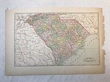
Vintage Colored Map of South Carolina 5.75x9in
$13.07

Vintage red printed map of USA United States Mean annual temp and rainfall
$13.07

Map of British Columbia Vintage Full Color Paper Map Hammond's 7x10in Aged Edges
$13.07

VINTAGE 1978 Map of Escondido California, Chamber of Commerce
$9.95

Los Angeles Map approx 21" x 41" New Old Stock
$4.99

Map Laminated Manhattan Queens Brooklyn [Pay As You Wish] New York NY
$3.99


